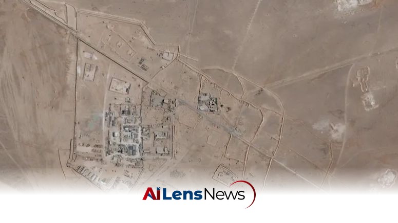


The EU has agreed to postpone the public release of Copernicus satellite images of the Gulf region by 24 hours following a request from the US, amid rising military tensions with Iran.
Kuwait City, Kuwait Jul 25, 2026 ALN: The European Union's recent decision to delay the release of Copernicus satellite images covering the Gulf region, following a request from the United States, highlights the intricate dynamics of international relations, security concerns, and the strategic value of satellite imagery in today's geopolitical landscape. This postponement, which involves a 24-hour delay in the publication of data collected by the Sentinel-1 and Sentinel-2 satellites, reflects the heightened tensions in the Gulf, particularly in light of recent military operations and ongoing disputes between the U.S. and Iran.
At the core of this situation is the strategic significance of the Gulf region, particularly the Strait of Hormuz, a vital maritime chokepoint through which a substantial portion of the world’s oil supply is transported. The Strait is crucial not only for oil exports but also for global trade, as any disruption in this area can lead to significant fluctuations in energy prices and impact economies worldwide. The recent uptick in military operations by the United States against Iran, which resumed approximately two weeks prior to the EU's decision, has further intensified these tensions. Historically, the U.S. has maintained a robust military presence in the Gulf, aimed at ensuring the uninterrupted flow of commerce and countering perceived threats from Iran, which has been accused of various aggressive actions in the region, including attacks on oil tankers and military installations.
The formal request for a delay in the release of satellite imagery was submitted by U.S. officials to the EU High Representative for Foreign Affairs and Security Policy, Kaja Kallas, on May 26. Following this request, the Council of the European Union, in its decision dated July 13, deemed it necessary to postpone the release to prevent potential misuse of the satellite data by any third parties, whether state or non-state actors. This precautionary approach underscores the EU's commitment to protecting its interests and those of its member states and allies in a region characterized by volatility and conflict.
The Copernicus program, which operates a fleet of Sentinel satellites, plays a pivotal role in providing Earth observation data for a variety of applications, including environmental monitoring, disaster response, and maritime surveillance. The Sentinel-1 satellite specializes in radar imaging, which can be utilized to monitor changes in land and sea, while Sentinel-2 offers high-resolution optical imagery that is valuable for assessing land use, vegetation, and the impact of disasters. The data generated by these satellites is indispensable for both civilian and military applications, making it a critical asset in the context of international security. The dual-use nature of satellite imagery complicates the governance of such data, necessitating a careful balance between accessibility and security.
The implications of this decision extend beyond immediate military operations and maritime security concerns. By delaying the release of satellite images, the EU and the U.S. are signaling a collaborative approach to managing regional tensions, which could have broader ramifications for transatlantic relations and the EU's role in global security. The EU's willingness to accommodate U.S. requests may be perceived as a reaffirmation of the longstanding alliance between the two entities, particularly in light of shared challenges posed by Iran's activities in the Gulf. This collaboration may also serve to strengthen the EU's position as a key player in international security discussions, particularly regarding the Middle East.
Furthermore, this incident raises critical questions about the transparency and accessibility of satellite data in the context of international security. While the Copernicus program is primarily designed for civilian use, the dual-use nature of satellite imagery means it can also serve military purposes. This duality complicates the governance of satellite data and necessitates careful consideration of how such information is disseminated, especially in sensitive regions like the Gulf. The challenge lies in balancing the need for security with the principles of transparency and accessibility, which are central to the EU's objectives.
Critics of the EU's decision may argue that such actions could undermine its credibility as a promoter of open data and environmental monitoring. The Copernicus program, in particular, is heralded for its commitment to providing timely and accurate data for environmental and humanitarian purposes. By delaying the release of satellite imagery, the EU risks sending a message that security concerns may take precedence over its commitment to transparency, potentially eroding public trust in its initiatives.
As tensions in the Gulf continue to evolve, the role of satellite imagery in monitoring and responding to regional developments will remain critical. The ability to observe and analyze changes in military activity, shipping patterns, and environmental conditions will be essential for informing policy decisions and ensuring the safety of maritime navigation. The EU's decision to delay the release of satellite images reflects a pragmatic approach to navigating these complexities, but it also highlights the ongoing challenges of managing security in a region marked by uncertainty.
In conclusion, the EU's agreement to delay the public release of Copernicus satellite images at the request of the U.S. is a significant development in the context of Gulf region tensions. It underscores the intricate relationship between satellite technology, international security, and the geopolitical landscape. As the situation unfolds, the implications of this decision will likely resonate beyond the immediate timeframe, influencing future interactions between the EU, the U.S., and other stakeholders in the region. The balance between security needs and the principles of transparency will continue to be a focal point of discussion as nations navigate the complex realities of modern geopolitics. The ongoing dialogue surrounding the governance of satellite data, its accessibility, and its implications for international security will be crucial as global dynamics shift and evolve.
To learn more about the latest developments in Crime & Law, stay updated with our exclusive reports and analyses on AiLensNews.