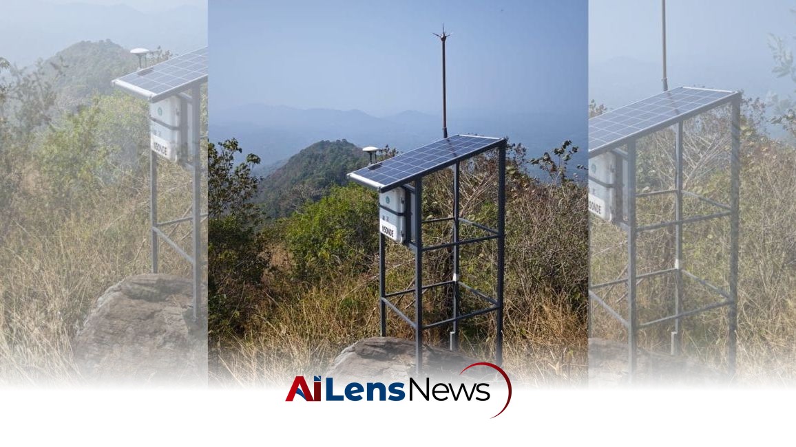


Kerala is implementing its first landslide early warning system at Madassery Hill, capable of predicting slope failures up to 24 hours in advance.
Doha, Qatar Jul 14, 2026 ALN: Kannur: Kerala is set to get its first landslide early warning system capable of predicting slope failures at least 24 hours in advance, giving authorities enough time to evacuate people from vulnerable areas before disaster strikes. This initiative reflects the increasing recognition of the threats posed by natural disasters in a region that is particularly susceptible to landslides due to its topography and climatic conditions.
The pilot project is coming up at Madassery Hill in Kanichar grama panchayat, on the Kannur-Wayanad route. The panchayat, near the Aralam Wildlife Sanctuary, witnessed around 34 landslides in 2022, making it one of Kerala's most landslide-prone regions. In recent years, Kerala has experienced a significant increase in extreme weather events, attributed in part to climate change. This has heightened the risk of landslides, especially during the monsoon season when heavy rainfall can saturate the soil and destabilize slopes.
"The minimum lead time we can provide is about 24 hours because the prediction is linked to the India Meteorological Department's rainfall forecasts," said Dr Debi Prasanna Kanungo, Chief Scientist and Professor at the Geotechnical Engineering and Geohazards Division of the CSIR-Central Building Research Institute (CBRI), Roorkee, who is leading the scientific work. "Once the warning threshold is crossed, the government can evacuate people living in the vulnerable area before the landslide occurs," he explained. This proactive approach is crucial for saving lives and minimizing property damage in areas where landslides are a recurring threat.
The nearly ₹2-crore project is being implemented jointly by the Kerala State Disaster Management Authority (KSDMA), the Kerala Development and Innovation Strategic Council (K-DISC), and CBRI, a CSIR institute located on the IIT Roorkee campus in Uttarakhand. This collaboration underscores the importance of integrating scientific research with local governance to address pressing environmental challenges.
A weather monitoring station was installed at the site in January as the first phase of the project. The next stage involves drilling boreholes and installing sensors 15 to 20 metres underground at eight locations from the top of the hill to its base. These sensors are designed to monitor various parameters that can indicate the potential for a landslide, including soil moisture, underground water pressure, and ground movement.
Before the sensors are installed, scientists carry out geological and geophysical surveys to map the underground layers of soil and rock. This preliminary work is essential for understanding the specific characteristics of the terrain, which can vary significantly from one location to another. The system then continuously monitors rainfall, soil moisture, underground water pressure, and even tiny movements within the slope using specialized sensors developed by IIT Roorkee. This technological integration represents a significant advancement in disaster risk management.
The data collected during the first monsoon is used to determine the rainfall threshold at which the slope becomes unstable. That threshold is then combined with IMD's rainfall forecasts. If the forecast indicates rain intense enough to push the slope beyond the danger limit, the system automatically issues an alert. This predictive capability is vital for timely evacuations and can potentially save lives by providing critical information to local authorities and residents.
"The triggering factor for most landslides in Kerala is rainfall," Dr Kanungo said. "We first establish how rainfall changes soil moisture, underground water pressure, and ground movement. Once those thresholds are scientifically established, we integrate them with the IMD forecast to predict landslides." This scientific approach ensures that the warning system is based on empirical data and rigorous analysis, enhancing its reliability and effectiveness.
Warnings can be issued through sirens, display boards, and mobile phones. Even if mobile connectivity fails during extreme weather, a node coordinator installed at the site can independently analyze the sensor data and trigger alerts. This redundancy is crucial in a region where communication infrastructure may be compromised during severe weather events, ensuring that residents receive timely warnings regardless of the circumstances.
Dr Kanungo said the system is designed for chronic, recurring landslide-prone slopes rather than sudden, first-time slope failures. This focus on chronic conditions allows for more accurate predictions and proactive measures, as authorities can monitor known high-risk areas continuously. "If high-risk slopes are identified in advance and monitored continuously, authorities can evacuate people whenever the warning threshold is crossed," he said, emphasizing the importance of ongoing vigilance in disaster-prone regions.
To conserve power, the sensors remain in sleep mode during normal weather and automatically switch to high-frequency monitoring during heavy rainfall or whenever they detect changes in soil moisture, water pressure, or ground movement. This energy-efficient design is particularly important in remote areas where power supply may be inconsistent, ensuring that the system remains operational when it is most needed.
Officials said the Madassery installation will also help assess landslide risks in nearby areas with similar geological conditions. The findings and data collected from this project could provide valuable insights for future projects aimed at enhancing disaster preparedness across the state. If the pilot project proves successful, the technology will be expanded to other landslide-prone regions of Kerala, including Wayanad, which has also faced significant challenges related to landslides and extreme weather.
According to Dr Kanungo, the landslide early warning system has already been installed at vulnerable sites in Uttarakhand and Nagaland, while similar projects are currently being implemented in Kerala, Darjeeling, and Sikkim. These initiatives highlight a growing trend across India to adopt advanced technologies for disaster risk reduction, reflecting a broader commitment to enhancing resilience in the face of climate change and its associated risks.
In conclusion, the establishment of the landslide early warning system in Kerala marks a significant step forward in the state's disaster management efforts. With the potential to save lives and reduce the impact of landslides on communities, this project exemplifies the importance of scientific innovation and collaboration in addressing the challenges posed by natural disasters. As climate change continues to influence weather patterns and increase the frequency of extreme events, such proactive measures will be essential for ensuring the safety and resilience of vulnerable populations in Kerala and beyond.
To learn more about the latest developments in Climate Change, stay updated with our exclusive reports and analyses on AiLensNews.